Tropical-cyclone wind reconstruction
Wind fields and intensity from geostationary imagery
geo2wf estimates tropical-cyclone surface wind fields, maximum sustained wind, and wind radii from geostationary satellite imagery. These are the companion docs for the accepted paper Nowcasting of Tropical Cyclone Wind Fields and Intensity from Geostationary Imagery.
The paper asks whether learning spatial wind structure helps estimate storm intensity, especially during rapid intensification. A shared U-Net encoder supports both SAR-supervised field reconstruction and a latent MLP for scalar intensity and radii. SAR is needed for training supervision; inference uses GEO imagery and deterministic context, with ERA5 as an optional input.
Use the project
- Get started: install the package and locate data and model files.
- Dataset: understand the published catalog, inputs, targets, and local loading format.
- Models: choose a field model, joint model, scalar correction, or forecast.
- Train and evaluate: use the retained presets and checkpoint workflows.
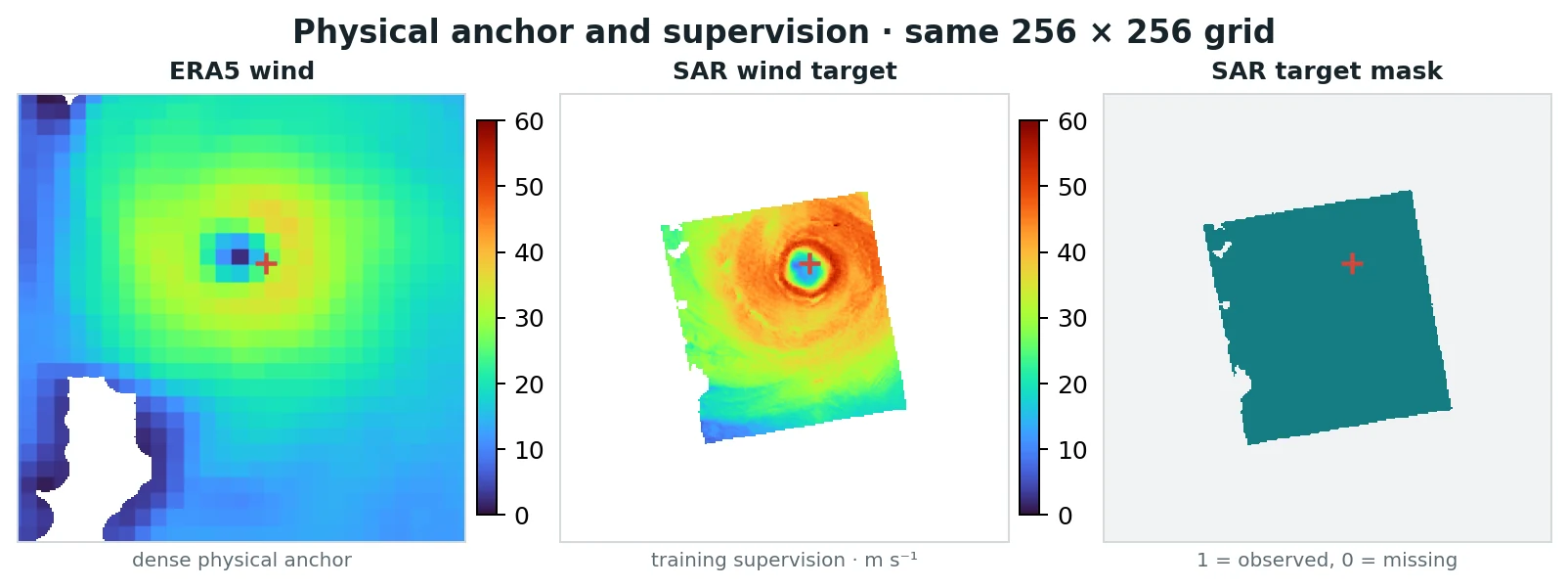
An exported training example: ERA5 context, a sparse SAR wind retrieval, and its validity mask. Supervised field errors are measured only where SAR is observed.
Scope
Field models reconstruct the observation time. The separate scalar forecast predicts six-hour intensity change. StormSense provides retrospective case studies of Humberto, Kiko, and Otis. The paper discussion explains the observational limits and why this is a research workflow rather than a validated operational product.